Preparation of Asi and Seyhan Basins Flood Management Plans (MINISTRY OF AGRICULTURE AND FORESTRY GENERAL DIRECTORATE OF WATER MANAGEMENT) (Ministry Of Agrıculture And Forestry General Directorate Of Water Management)
Date:Haziran 2018-Aralık 2021
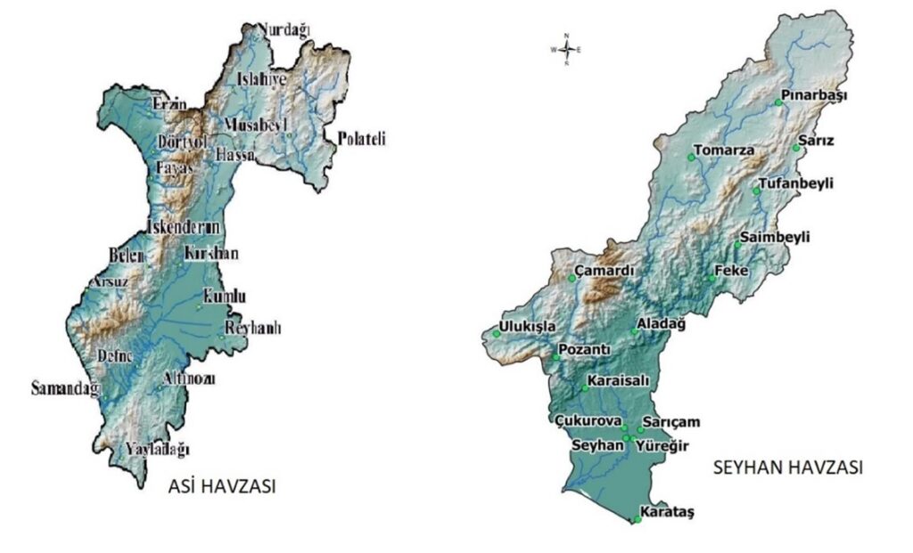
Work Details: Asi and Seyhan Basins, which cover all or parts of Hatay, Gaziantep, Kilis provinces (for Asi Basin) and Adana, Kayseri, Niğde provinces (for Seyhan Basin), involve the following tasks in the preparation of Flood Management Plans:
- Conducting preliminary flood risk assessment,
- Creating flood hazard maps,
- Developing flood risk maps,
- Identifying necessary precautions to be taken before, during, and after floods based on the flood risk data. Separate Flood Management Plans are prepared for the Asi and Seyhan Basins.
The definition of actual services provided in the task:
- For the Asi and Seyhan Basins separately, preparing a Preliminary Report that includes organizing and evaluating all relevant data as required by the administration for creating the Flood Risk Preliminary Assessment Report, including the basin’s characteristics, hydrological, meteorological, and topographic features, geological structure, soil composition, vegetation cover, erosion status, socio-economic situation, current use of the basin (existing water structures and similar facilities, agriculture, forests, residential areas, organized industrial zones, etc.), protected areas within the basin, cultural assets, and information about past floods in the basin.
- Asi and Seyhan Basins, separately, the potential adverse effects of past and future floods on human health, the environment, cultural heritage, and economic activities, considering topography, river and stream routes, natural water retention areas, floodplains, general hydrological and geological characteristics, the effectiveness of existing infrastructure, the location of settlement areas, economic activity areas, strategic structures, and the possible impacts of climate change, are addressed in the Flood Risk Preliminary Assessment Report,
- In the Asi and Seyhan Basins, separately, the Flood Risk Preliminary Assessment Report recommends conducting flood hydrology studies for risk-prone locations using both hydrological models and classical methods, and preparing a Hydrology Report.
- Using the numerical data in the project, a one-dimensional and two-dimensional hydrodynamic model should be created. The model should process all existing structures on riverbeds and determine water changes along cross-sections.
- Creating Flood Hazard Maps using flood peak discharges in residential areas and economic activity zones.
- Flood Risk Maps should be created using GIS databases to highlight the risks in each area shown on the Flood Hazard Maps
- Preparation of Flood Management Plans separately for the Asi and Seyhan Basins.
- The task of updating or enhancing the database using previously created data and data generated within the scope of the work.